Why I Built Selkie Tech Vector Weather
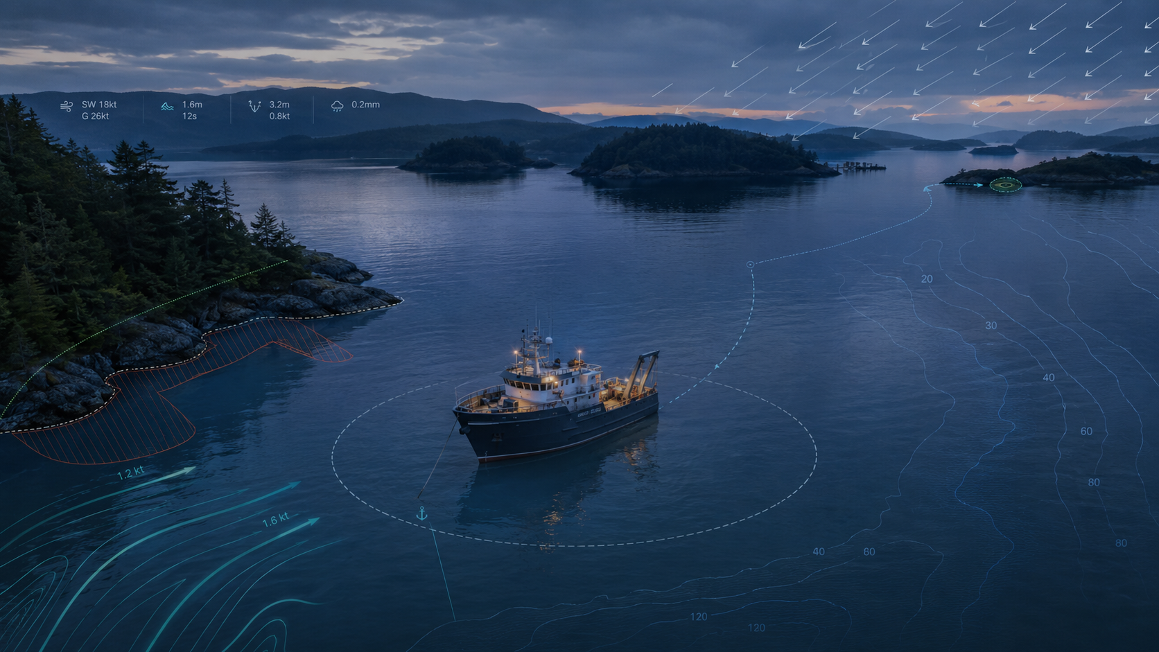
At sunset, SENA II can be perfectly quiet while I am already thinking about three o’clock in the morning.
The forecast says the wind will shift. The tide will fall. Perhaps the breeze will strengthen. The wind may clock. Those facts matter, but they do not answer the question that matters when I am sleeping aboard:
What will those conditions do here, to this boat, in this anchorage?
That question led me to build Selkie Tech Vector Weather, a marine decision-support product developed by Selkie Tech, a division of RO IT Systems Ltd.
I have spent more than 1,000 nights at anchor and three decades operating pleasure craft, workboats, and fishing vessels in coastal and inland waters. I have navigated thousands of miles and completed more than 300 days of commercial work aboard vessels of up to 300 tonnes displacement.
Over those years, I have watched mariners and paddlers make decisions with information that was good, but scattered, incomplete, difficult to compare, or available too late to be useful.
The information exists, but the complete picture often does not
Marine weather can be difficult to interpret, especially in unfamiliar waters.
Usually, the problem is more complicated than failing to check the forecast. High-quality weather products, tide predictions, charts, observations, and local knowledge already exist.
The difficulty is bringing the relevant information together when the decision is being made.
A person may know the forecast wind speed without recognizing how sharply the direction will change. They may not know that a nearby pass becomes dangerous when wind opposes current, that a falling tide changes water depth and anchoring scope, or that a moderate wind has enough open fetch to build steep local waves.
Each piece of information can be correct while the overall picture remains unclear.
By the time the consequences become visible on the water, the useful decision window may already have closed.
A forecast is not yet a decision
A forecast might say the wind will be northeast at 20 knots. That is valuable information, but it does not describe the full operational effect.
Twenty knots can mean very different things in a protected cove, on a lee shore, inside a narrow channel, or across ten miles of open fetch.
The same wind affects a sea kayak, a light sailboat, and a 300-tonne workboat differently. Swell, current, terrain, water depth, hull form, ground tackle, crew condition, and route timing all matter.
Before Vector Weather, answering these questions often meant moving between several weather services, tide tables, current predictions, charts, buoy observations, and sailing directions. The operator then had to build a mental model from information published in different formats, at different resolutions, and on different schedules.
Experienced mariners do this routinely. Experience does not eliminate workload, and unfamiliar waters make the task harder.
The gap I wanted to address was the work of turning available information into useful, vessel-specific context.
Starting with the boat and the place
Vector Weather starts with a specific vessel and a specific anchorage, location, or route.
For an anchorage, I use it to examine the overnight timeline: forecast wind and gusts, expected shifts, tide, water depth, waves, fetch, terrain shelter, and the scope my ground tackle may require as conditions change.
It helps me ask practical questions while there is still time to act:
- Will a protected anchorage become exposed after the wind shifts?
- Will the falling tide leave too little water beneath the vessel?
- Will the new wind direction build uncomfortable or hazardous chop?
- Will wind oppose a local current and steepen the sea?
- Is my planned scope appropriate during the most heavily loaded part of the forecast?
- Which nearby alternatives deserve closer examination?
For a passage, the same principle applies along the route. Conditions are considered where the vessel is expected to be, rather than only at the departure point.
A departure that looks reasonable at the dock may place the vessel at a difficult headland or tidal pass at exactly the wrong time.
For paddlers, the consequences can be immediate. A generic wind forecast says little about how wind, waves, current, fatigue, experience, and limited landing options will combine on a particular leg.
The relevant question is what those conditions may mean for that paddler, in that kayak, at that point on the route.
Safe shelter is also an access question
For many people, shelter on the water is not simply part of a recreational itinerary.
Commercial crews may face operating constraints. Paddlers may have few safe landing places. Liveaboards may be looking for somewhere they can safely remain overnight because their vessel is also their home.
Access to safe and familiar shelter is becoming more restricted in many coastal communities. When sheltered anchorages become regulated, time-limited, or unavailable, people may be pushed toward less familiar or more exposed locations.
Better information cannot replace fair access to public waters, adequate housing, or responsible coastal planning.
It can help people understand the risks they are being asked to carry when their choices are already constrained.
Safety technology should serve people who are exposed to risk, rather than assume every user has unlimited money, mobility, local knowledge, or access to a marina berth.
A structured second set of eyes
I think of Vector Weather as a structured second set of eyes.
It brings together forecasts, official marine products, observations, tides, currents, waves, bathymetry, terrain, fetch, and known local hazards. It then relates those conditions to a vessel profile, anchoring system, route, or paddling context.
Its purpose is to make the factors worth considering easier to see before the weather changes.
No software knows everything about a vessel, crew, anchorage, or sea state. Data can be delayed, incomplete, unavailable, or wrong. Local effects can occur below the resolution of even a good model.
The person responsible for the vessel must still compare the analysis with official forecasts, charts, onboard observations, local knowledge, and prudent seamanship.
Artificial intelligence has a useful but bounded role. It can organize information, identify interactions, explain why a condition may matter, and draw attention to uncertainty.
It does not inherit the operator’s accountability. When I use AI-assisted analysis to support a decision aboard, the decision remains mine.
The technology challenge
Building Vector Weather reinforced something I have learned repeatedly in enterprise technology: the difficult problem is rarely obtaining more data.
The difficult work is determining whether the data is current, where it came from, what area and time it represents, how it relates to other sources, and what the system should do when a source is unavailable.
Marine information arrives from weather agencies, hydrographic services, forecast models, tide stations, current stations, buoys, charts, and local products. These sources use different formats, resolutions, schedules, and geographic boundaries. Sometimes they disagree.
That makes timestamps, provenance, validation, fallback logic, and visible uncertainty core product features.
The same discipline applies to AI. A system can produce a confident explanation from incomplete or mismatched inputs. The surrounding controls must show where information came from, expose its limitations, and prevent fluency from being mistaken for certainty.
Marine decisions deserve traceable data, clear assumptions, controlled failure modes, and a human being who remains accountable.
What I want Vector Weather to become
My vision is for Vector Weather to help people anticipate conditions rather than merely encounter them.
I want someone considering an unfamiliar anchorage to see why it may become exposed later in the night. I want a person planning a coastal passage to recognize that their arrival at a narrow channel may coincide with opposing current and deteriorating wind. I want a kayaker to understand how the forecast sea state relates to their boat, skill, fatigue, and available landing places.
The details differ off British Columbia, France, Mexico, South Africa, or on an inland mountain lake. The core need remains the same: assemble the best available information, relate it to the local geography and the vessel, and show what may change over time.
Over time, I envision Vector Weather connecting planning ashore with observation aboard while remaining clear about the origin, confidence, and limitations of what it presents.
Most importantly, I want it to help preserve the decision window.
The best time to discover that an anchorage will become exposed is before the anchor begins to drag.
The best time to learn that wind against current will make a pass dangerous is before entering it.
The best time to reconsider a kayak crossing is before the nearest safe landing is behind you.
Marine weather information is abundant. The challenge is bringing the relevant pieces together early enough to support a better decision.
Vector Weather is my attempt to preserve that decision window by turning scattered marine information into vessel-specific context before conditions become urgent.